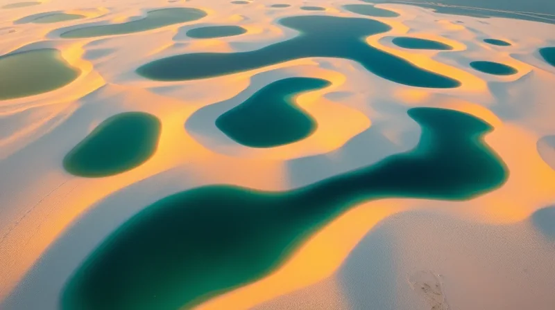
Desert dunes transform into seasonal lagoons in Brazil
Most people come to northeastern Brazil looking for beaches. Scientists came looking for sand. What they found instead was a landscape that defies every rule of desert geography - a place that looks like the Sahara from above but behaves like the Florida Everglades from the ground. The discovery was never planned. It emerged from satellite imagery intended for a completely different purpose: tracking coastal erosion along the South American coastline.
The images revealed something impossible. Rows of white quartz dunes, some rising 30 meters high, sat surrounded by hundreds of blue and green lagoons. The scene looked like a mistake, a rendering error, a trick of light. But the data was consistent across multiple passes. The dunes were real. The water was real. And the combination was unlike anything else on the planet. The accidental discovery forced researchers to ask a question that had never been asked before: what happens when a desert receives more rain than Seattle?
The answer lies in a geological accident that took hundreds of thousands of years to assemble. The Lençóis Maranhenses National Park sits on an unusually flat stretch of the Maranhão coastline. Rivers including the Mearim and Parnaíba have delivered massive quantities of quartz sand to this location over millennia. Fluctuating sea levels pushed the shoreline back and forth, layer upon layer, creating a foundation that would eventually become the largest coastal dune field in South America. The sand accumulated for hundreds of thousands of years before the conditions were right for what happens next.
When the Water Table Refuses to Drain
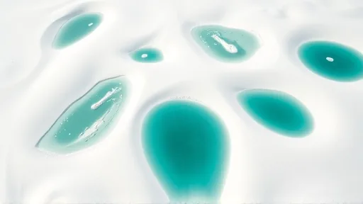
The park receives about 125 centimeters of rain per year. That is slightly more than Seattle receives annually and double the amount that falls on London. In any normal desert, that water would simply evaporate or drain away. But the Lençóis Maranhenses dunes sit on something unusual: a partially impermeable layer of bedrock and clay beneath the sand. This underground barrier acts like a bathtub lining, trapping the water where it falls.
During the wet season, the lagoons fill to their peak levels. The water table rises until it meets the surface, flooding the spaces between the dunes. The result is a mosaic of freshwater pools in every shade of blue and green. From above, the shallower lagoons appear light blue, often taking on turquoise or aquamarine hues as sunlight reflects off the sand below. Deeper lagoons appear darker because the deeper water absorbs more red, yellow, and green wavelengths, leaving mostly blue light to scatter back to the surface.
The colors are not purely optical. Suspended sediment, microscopic algae, and dissolved organic matter all contribute to the array of tones, giving some lagoons greener and browner shades. The water is fresh, not saltwater - a crucial distinction that makes this ecosystem completely different from a coastal marsh or mangrove swamp. The lagoons support fish, crustaceans, and plant life that have adapted to a peculiar rhythm: months of abundance followed by months of absence.
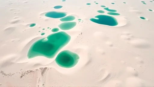
Between August and November, the rains subside. The water table begins to fall, and the lagoons slowly shrink. By December, most of them have dried up completely. The landscape reverts to what it appears to be at first glance: a desert of white sand stretching to the horizon. Then the rains return, and the cycle begins again. This annual transformation is not a slow evolution - it is a dramatic, predictable pulse that drives everything in the park.
The Moving Sands That Connect Three Worlds
The dune field spans about 900 square kilometers, roughly the size of New York City. It sits at the intersection of three Brazilian biomes: the Amazon rainforest to the west, the tropical wooded savannas of the Cerrado to the south, and the dry shrublands and thorn forests of the Caatinga to the east. Closest to the dunes are mangroves and restinga forests, ecosystems well adapted to sandy, coastal soils. The green vegetation that surrounds the dune field marks the boundary between worlds.
The dunes themselves are not static. Persistent easterly trade winds drive them westward at a pace of roughly 4 to 25 meters per year. During the dry season, winds often reach at least 50 kilometers per hour - fast enough to move significant amounts of sand. This movement is rapid by geological standards but not the fastest on Earth. Satellites have tracked small barchan dunes in Namibia’s Sperrgebiet region moving at rates exceeding 80 meters per year. The Brazilian dunes are slower, but they are still alive, still shifting, still reshaping the landscape.
The park’s name comes from the Portuguese word lençóis, meaning “bedsheets.” The reference makes sense only from the air. From that perspective, the sweeping curves of the dunes resemble a rumpled white bedsheet thrown across the landscape. The image is poetic but also precise: bedsheets are moved by sleepers, rearranged by hands, never quite settled. The dunes of Lençóis Maranhenses behave the same way, pushed by wind, shaped by rain, and transformed by a water table that refuses to follow the rules of desert geography. For anyone who studies coastal systems, this place is a reminder that the categories we create - desert, wetland, forest - are human inventions. Nature does not read the textbooks.