Moon crater spotted by repurposed NASA camera
The Moon is a silent witness to human activity. Since the first artificial object touched its surface in 1959, dozens of spacecraft have ended their journeys there. Most of those impacts were intentional, designed to test instruments or deliver scientific payloads. Some were accidents, the result of lost control or failed maneuvers. The crater that formed on August 5, 2025, however, belonged to a new category: a piece of modern space infrastructure, a rocket upper stage from a commercial launch, slamming into the lunar soil at high velocity. [5] The object in question was the upper stage of a SpaceX Falcon 9 rocket, the same vehicle that had launched the Firefly Blue Ghost 1 mission in January of that year. [5] After completing its primary job of pushing the lunar lander toward the Moon, the spent stage had been left in a chaotic orbit. For months, it drifted, tugged by the gravity of Earth and the Moon alike. Then it found its final resting place, carving a fresh scar into the ancient regolith.
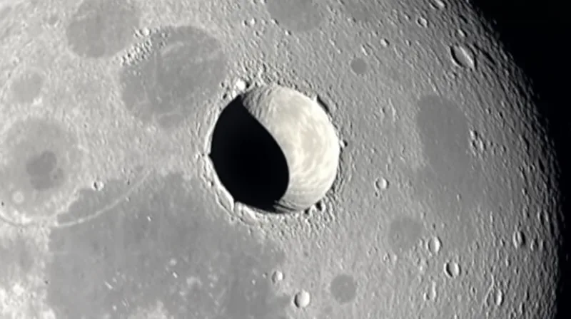
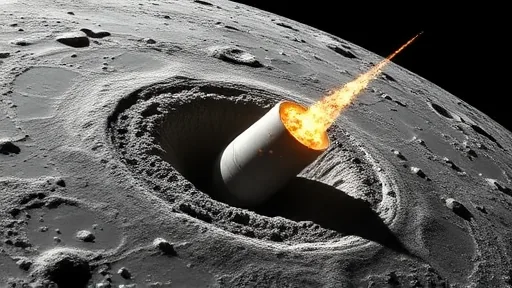
This was not a random event. It was a predictable one, and that predictability is what makes the story remarkable. . For decades, the scientific community has worried about the growing population of derelict hardware circling the Earth-Moon system. Most of it is tracked, cataloged, and monitored. But the Moon itself has no atmosphere to burn up wayward objects. Anything that gets pulled into a lunar collision arrives at full speed, often around 6,000 miles per hour. The Falcon 9 upper stage was no exception. When it struck, it dug a hole roughly 60 feet wide and less than 10 feet deep. For comparison, that is about the width of a standard bowling lane doubled, and the depth of a typical backyard swimming pool. The impact excavated material from as far as 1.5 feet below the surface, throwing it outward in a pattern of bright and dark rays that now stretch across the lunar landscape. .
What happened next involved a global chain of coordination. Independent astronomers, working with publicly available trajectory data, first identified where the rocket was heading. Their calculations were passed along, refined, and eventually handed to NASA’s Center for Near Earth Object Studies, a group based at the Jet Propulsion Laboratory in Southern California. [6] That center, which normally tracks asteroids and comets that might threaten Earth, used the rocket impact as a test case. The goal was to validate tools and techniques for predicting where objects will hit, a skill that could one day prove critical for planetary defense. The center incrementally refined the trajectory until it pinpointed the impact location. [6] Then it sent those coordinates to the Republic of Korea, whose Korea Pathfinder Lunar Orbiter, known as Danuri, was already circling the Moon. [3]
The Danuri team used a high-resolution camera called LUTI to image the crater just a few hours after the impact. [3] Their prediction had been accurate to about 0.6 miles, a remarkable feat given the complexities of lunar gravity and the chaotic nature of the rocket’s final orbit. . [3] The Korean team then shared their images and coordinates with NASA’s Lunar Reconnaissance Orbiter team, which used that information to plan a more detailed follow-up. [4] The collaborative effort did not end there. By comparing the new crater images with pre-impact photos of the same region, the LRO team updated the crater’s precise center coordinates: 19.4759 degrees north latitude, 266.7138 degrees east longitude, at an elevation of 511 meters. . [4] Those numbers may seem dry, but they represent a new pin on the map of lunar history, a marker of humanity’s expanding footprint beyond Earth. ### A Camera Designed for Scanning, Not Watching
The instrument that captured the clearest views of the crater was not designed for this task. [4] The Narrow-Angle Camera aboard NASA’s Lunar Reconnaissance Orbiter was built for a different purpose entirely. Its original mission was to map the Moon’s surface in detail, to help scientists understand the geology of our nearest neighbor and to scout potential landing sites for future missions. The camera can spot features as small as 3 feet across, a resolution sharp enough to distinguish a small boulder from a shadow. But photographing a specific, newly formed crater required a maneuver the mission planners had never intended. The orbiter travels at about 1 mile per second, circling the Moon from pole to pole every two hours. The Moon itself rotates slowly beneath it. To capture a particular spot, the spacecraft must wait until that location swings into view, a process that took six days in this case.
The engineering challenge went beyond just waiting for the right moment. The team had to tilt the entire spacecraft so that the camera would point directly at the crater each time the orbiter passed overhead at an altitude of about 60 miles. Timing was critical. If the camera snapped its image even 10 seconds too early or too late, the target would drift off-center by 10 miles. That margin of error is roughly the distance from downtown Los Angeles to the beach. Missing the target would have meant another six-day wait, or worse, losing the opportunity altogether. The team had to calculate the spacecraft’s position, the crater’s location, and the Moon’s rotation with extraordinary precision, all while accounting for the subtle gravitational tugs of the lunar mass concentrations that can pull an orbiter off course.
The effort paid off. Because the orbiter passed over the crater from multiple angles over several days, scientists were able to observe it under different lighting conditions. Each pass revealed different features. In some images, the crater rim stood out sharply, allowing scientists to measure its width. In others, the shadow cast by the rim gave them a way to estimate the depth. The variety of viewing angles provided a three-dimensional picture that a single photograph could never have offered. This is a fundamental lesson in planetary science: one image is a snapshot, but multiple images taken from different perspectives are a map. The LRO team now has that map, and it tells a story about what happens when human-made hardware meets the lunar surface at hypersonic speed.
The images also revealed something subtler. The dark streaks radiating from the crater are not just dust. They are material that has been weathered over eons by solar wind, galactic cosmic rays, and micrometeorite impacts. . This altered regolith, which had been buried 1.5 feet below the surface, was excavated by the collision and thrown outward. . The brighter streaks near the rim, by contrast, are made of fresh material from deeper underground, material that had never been exposed to the harsh space environment. By studying these rays, scientists can learn about the composition of the lunar subsurface without having to dig a single hole. The crater is, in effect, a natural excavation experiment, one that reveals the hidden layers of the Moon’s crust.
The Limits of Watching from Above
The success of this imaging campaign highlights a persistent challenge in lunar observation. The Lunar Reconnaissance Orbiter has been circling the Moon since 2009, far exceeding its original design life. Its instruments, including the Narrow-Angle Camera, were built to last a few years, not nearly two decades. Every maneuver, every image, every moment of operation is a testament to the engineering that went into the spacecraft. But the mission also operates under real constraints. The orbiter can only photograph a given spot when its orbit and the Moon’s rotation align. That means some events are missed entirely, and others, like this impact, require careful planning and patience. The six-day wait for the crater to come into view is a reminder that orbital mechanics do not bend to human schedules. The collaboration between NASA and the Korean space agency represents a new model for lunar exploration. No single nation or agency can monitor the entire Moon with the detail that modern science demands. The Danuri orbiter, with its LUTI camera, provided a crucial early look at the crater, confirming the impact location and giving the LRO team a target to aim for. This kind of coordination, where one mission’s data feeds directly into another mission’s planning, is becoming the standard for planetary science. It is also a practical necessity. The Moon is a vast place, and the number of instruments capable of resolving features just a few feet across is still very small. Each new crater, each new impact, each new piece of debris that reaches the surface adds to a growing catalog of human-made artifacts on another world. .
The Falcon 9 crater will remain on the Moon for millions of years. There is no wind, no rain, no erosion to erase it. It will sit there, a permanent record of a January launch and an August impact, a testament to the reach of human technology. But it also raises questions that the current images cannot answer. What exactly was the composition of the material at the impact site? How much of the ejecta was vaporized by the heat of the collision? What does the crater’s shape tell us about the angle and speed of the impact? These are questions for future missions, for instruments that do not yet exist, for orbiters and landers that have not yet been designed. The images from LRO and Danuri are a beginning, not an end. They confirm that the impact happened, they map its location, and they reveal its immediate aftermath. But the full story of what that collision means, for the Moon and for the future of space exploration, is still being written.
Sources
1. NASA
3. Korea Pathfinder Lunar Orbiter
4. NASA’s Lunar Reconnaissance Orbiter
5. SpaceX