
Digital Twins Reveal Flood Risk Maps Cannot Show
A map can show where water might rise. It cannot show how a family will feel when that water reaches their door. This gap between statistical risk and lived experience sits at the heart of California’s growing flood problem.
The numbers are stark. Approximately 1.4 million Californians live in areas at high risk of flooding each year. Climate change is driving this number upward, year after year.
Yet residents and policymakers alike struggle to grasp what this risk actually means. A FEMA map draws lines on paper. A designation like “100-year floodplain” sounds precise, even reassuring.
But these tools fail at their core task. They do not give people an intuitive understanding of how likely a flood is to occur in their lifetime. They cannot show what could happen when one does arrive.
Consider the phrase “100-year flood.” Many hear it as a promise: this will happen once a century. In truth, it means a one percent chance in any given year. Over a thirty-year mortgage, that risk compounds to roughly 26 percent. The map never explains this.
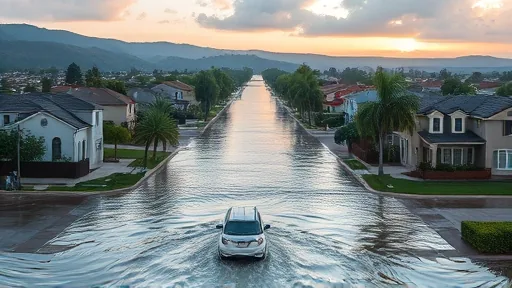
The gap is not just about perception. It affects decisions about where to build, how to insure, and when to evacuate. A tool that cannot communicate risk clearly becomes a liability rather than a safeguard.
A New Way to See the Rising Water
The limits of static maps have pushed researchers toward a different approach. Digital twins — virtual replicas of physical systems — offer a way to simulate flood scenarios in real time.
These digital models can show water moving through streets, around buildings, and across neighborhoods. They can demonstrate what a flood looks like before it happens. This makes the abstract concrete.
For a homeowner, the difference is profound. Instead of reading a probability on a page, they can watch their street disappear under simulated water. Instead of trusting a percentage, they see the depth, the speed, the path of destruction.
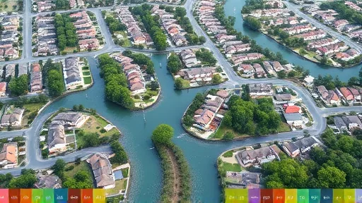
For policymakers, the advantage is equally clear. Digital twins allow them to test different responses before a crisis hits. They can ask: what happens if we open this dam? What if we build that levee? The model answers instantly.
The technology transforms flood risk from a concept into an experience. It bridges the gap between what statistics say and what people understand.
The Team Testing Whether It Works
The question now is whether digital twins can deliver on their promise. Researchers are preparing to put the technology to the test in California’s flood-prone regions.
The team behind this effort is examining whether these virtual models can accurately predict real-world flood behavior. Their work will determine if this approach can replace or supplement traditional mapping methods.
If successful, digital twins could become standard tools for flood management across the state. They could help the 1.4 million Californians at risk understand their danger with unprecedented clarity.
The research is still in its early stages. But the potential is clear: a tool that makes invisible risk visible, that turns statistics into stories, that helps people see what the maps cannot show them.